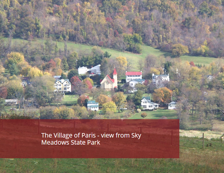
Paris originated as a crossroads in the 1790s at the foot of Ashby’s Gap in the Blue Ridge Mountains at the junction of Ashby’s Gap Turnpike (present day Route 50) and the Winchester-Dumfries Road (present day Route 17). Paris lies at the northern edge of what is called the Crooked Run Valley that extends eight miles to the south to I-66 and east to Rectortown.
The main street in Paris is the old roadbed of the original Ashby’s Gap Turnpike.
The historic area is comprised of approximately twenty-five resources along Main, Federal, and Republican Streets. The town is much smaller than originally envisioned. The original plat of the town proposed a total of 14 streets.
The historic buildings range in date from the early 19th to the mid-20th century, but the primary building type is the single dwelling. Many of the homes have some Federal details. A sizable number of them are of log construction and stand as testimony to staying power of rot-proof chestnut wood and traditional building methods.
The historic area also showcases several stores, two churches, a tavern, an old school, and an old gas station now converted into an antique shop.

